At Idre Fjäll and in northern Dalarna, there are hiking trails for everyone, regardless of age or experience. Many of the trails start right near your accommodation at Idre Fjäll, allowing you to head out easily without needing to drive. In the surrounding area, there are trails at Städjan, Nipfjället, Grövelsjön, and Fulufjället, and a bit further away, you can also find beautiful trails in Norway. Some trails are particularly suitable for running and are marked as trail loops.
Level: Easy
Distance: 5.4 km round trip
Total elevation gain: Approximately 230 meters
Estimated duration for adults: Approximately 1.5 hours
Difficulty level: Easy
Starting point: Skidstadion
Destination: Summit of Idre Fjäll and back
Car needed: No
Child-friendly: Yes
Facilities along the way: Restaurant Utsikten
Description: Ascend to the summit of Idre Fjäll and enjoy the view at 892 meters above sea level. Starting from Fäboden and Skills Area, continue along the summit trail. Please note that this trail is shared by both hikers and cyclists heading uphill. Show consideration to others! Along the way, you will see large piles covered with tarps or bark. This innovative method helps preserve snow for an early start to the alpine and cross-country skiing season. Once you reach the top, you can admire the expansive views and take a break at Restaurant Utsikten to catch your breath.
Coordinates starting point: 61.8923930, 12.8303440
Download GPX file: Summit of Idre Fjälls, GPX
Level: Easy
Distance: 5.3 km
Total elevation gain: 120 meters
Estimated duration for adults: 1 hour and 45 minutes
Difficulty level: Easy
Starting point: Slättvåla
Destination: Slättvåla
Marking: Pink markings
Trail manager: Idre Fjäll
Car needed: No, walk or bike to the starting point from your accommodation
Child-friendly: Yes
Facilities along the way: Bring a packed lunch.
Description: A moderately long hiking tour around Slättvåla, featuring perhaps the most beautiful untouched forest in the surroundings. The route is also suitable for a trail run. The terrain varies between narrow and wide paths, as well as shorter sections on gravel road. The starting point is located just beyond the Söderhöjden cottage area.
Coordinates starting point: 61.8811708, 12.8520469
Download GPX file: Slättvåla, GPX
Level: Easy
Distance: 1.3 km
Estimated time for adults: 0.5 hours
Difficulty level: Easy but steep
Starting point: The tunnel from Idre Fjäll’s square
Destination: The valley station of the South Gondola
Car required: No
Child-friendly: Yes
Description: A walking path to the valley station of the South Gondola from the tunnel at Idre Fjäll’s square. The surface consists of both a steep gravel road and a wide, smooth trail suitable for strollers. The final section is a multi-use trail shared with cyclists, so please be considerate.
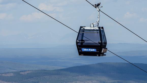
Tip! Take the South Gondola up to the mountain’s summit, enjoy the views, and have a coffee or lunch at Restaurant Utsikten. Round-trip tickets for the gondola can be purchased online or on-site via Swish.
Coordinates starting point: 61.890313, 12.831884
Download GPX-file: Sydgondolen,GPX
Level: Easy
Distance: 5 km round trip
Total elevation gain: Approximately 100 meters
Estimated duration for adults: Approximately 1.5 hours
Difficulty level: Easy
Starting point: Ski Stadium Idre Fjäll
Destination: Gränjestjärn and back
Marking: Blue-purple markings
Trail manager: Idre Fjäll
Car needed: No
Child-friendly: Yes
Facilities along the way: No. Bring a packed lunch to the shelter.
Description: Stroller, wheelchair, or hiking shoes? This is our most accessible hiking trail. From Ski Stadium, follow the asphalt path until a wide boardwalk leads you down to the idyllic Gränjestjärn below the foot of Städjan. Please note that the first and last 1.5 km of the hike are on the paved roller ski track. We kindly ask pedestrians to step off the asphalt well in advance when roller skiers pass by. A wide boardwalk leads to the first shelter, after which the boardwalk becomes narrower.
Coordinates starting point: 61.8923930, 12.8303440
Download GPX file: Gränjestjärn, GPX
Level: Easy
Distance: 1 km
Total elevation gain: 4 meters
Estimated duration for adults: Approximately 1 hour
Difficulty level: Easy
Starting point: Parking lot at Gränjestjärn
Destination: Gränjestjärn
Car needed: Yes
Child-friendly: Yes
Facilities along the way: Bring a packed lunch.
Description: For the youngest hikers or for those who simply want to enjoy the magical nature at Gränjestjärn. On the boardwalks, you can take a stroll around the lake, keep an eye out for cloudberries, and have a picnic in a shelter.
Coordinates starting point: 61.9062950, 12.8396950
Download GPX file: Gränjestjärn for the children, GPX
Level: Easy
Distance: 5.8 km
Total elevation gain: 70 meters
Duration for adults: Approximately 2 hours
Difficulty level: Easy
Starting point: Slättvåla
Destination: Idre Fjäll Ski Stadium
Marking: Light orange markings
Trail manager: Idre Fjäll
Car needed: No
Child-friendly: Yes
Facilities along the way: None
Description: A pleasant gravel road that offers varied nature, old-growth forest, and views of Städjan. The road takes you all the way around Idre Fjäll, where you can see all the slopes and changing vegetation.
Coordinates starting point: 61.892501637015336, 12.829542425548237
Download GPX file: Around the mountain - summer time, GPX
Level: Easy
Distance: 4 km
Total elevation gain: 35 meters
Estimated duration for adults: Approximately 1 hour
Difficulty level: Easy
Starting point: Idre Fjäll Ski Stadium
Destination: Idre Fjäll Ski Stadium
Marking: Yellow markings
Trail manager: Idre Fjäll
Car needed: No
Child-friendly: Yes
Facilities along the way: None
Description: The Tannen loop trail mostly passes through beautiful, slightly sparser forest. The terrain varies between forest trails and gravel surfaces.
Coordinates starting point: 61.892501637015336, 12.829542425548237
Download GPX file: Tannenslingan, GPX
Level: Easy
Distance: 5.3 km
Total elevation gain: 70 meters
Estimated duration for adults: Approximately 1.5 hours
Difficulty level: Easy
Starting point: Idre Fjäll Ski Stadium
Destination: Idre Fjäll Ski Stadium
Marking: Light blue color markings, blue and white signs
Trail manager: Idre Fjäll
Car needed: No
Child-friendly: Yes
Facilities along the way: None
Description: This is a moderate-length trail with a gravel surface. Along the route, you will pass through beautiful, open marshlands and enjoy views of Städjan and the Nipfälls massif.
Coordinates starting point: 61.892501637015336, 12.829542425548237
Download GPX file: Platten 2, GPX
Level: Easy
Distance: 1.5 km round trip
Total elevation gain: Approximately 130 meters
Estimated duration for adults: Approximately 45 minutes
Difficulty level: Easy
Starting point: Nipfjället's summer parking lot
Destination: Lillnipen and back down
Marking: Start sign at the summer parking lot
Trail manager: Länsstyrelsen Dalarna
Car needed: Yes
Child-friendly: Yes
Facilities along the way: Bring a packed lunch.
Description: A true classic and easily accessible peak. The climb to Lillnipen begins directly from Nipfjället's summer parking lot. This is guaranteed to be a favorite for families with children, and if you're lucky, you might see the reindeer with their calves grazing in the distance.
Tip! Visit Nipfjället during sunrise or sunset, as there are usually fewer hikers and it's easier to capture magical moments.
Coordinates starting point: 61.9601600, 12.8482440
Download GPX file: Lillnipen summit hike, GPX
Level: Easy
Distance: 2-5 km
Total elevation gain: Approximately 150 meters
Estimated duration for adults: Approximately 1 hour and 45 minutes
Difficulty level: Easy
Starting point: Nipfjällets sommarparkering (Nipfjället's summer parking lot)
Destination: Towards Städjan, turn back whenever convenient
Marking: No markings but a clear trail
Car needed: Yes
Child-friendly: Yes
Facilities along the way: Bring your own packed lunch
Description: A child-friendly hike that can be customized in length. If you choose the full 5 km loop, you'll have the opportunity to follow one trail to the ice age mounds and another trail back. The route offers magnificent views above the treeline with gentle terrain. At the mounds, children can enjoy pretend mountain climbing, and it's a lovely spot for a picnic before turning back to the parking lot.
Coordinates starting point: 61.9601600, 12.8482440
Download GPX file: Nipfjällets short hike towards Städjan, GPX
Level: Easy
Distance: 13 km
Total elevation gain: Approximately 200 meters
Estimated duration for adults: Approximately 4 hours
Difficulty level: Easy
Starting point: Nipfjället summer parking lot
Destination: Idre Fjäll
Marking: No continuous markings but a clear trail
Car needed: Yes
Child-friendly: No
Facilities along the way: Bring packed lunch
Description: If you have the opportunity to leave a car at the Nipfjället summer parking lot, you can enjoy a hiking route that involves more downhill sections than uphill, while still offering beautiful mountain views. You start at the popular Nipfjället and pass below the distinctive peak of Städjan. If you have enough energy, you can also climb to the top of Städjan before continuing down to Gränjåsvallen and then onward to Idre Fjäll.
Coordinates starting point: 61.9601600, 12.8482440
Download GPX file: Nipfjället-Städjan-Idre Fjäll, GPX
Level: Easy
Distance: 4 km
Estimated duration for adults: Approximately 1 hour and 30 minutes
Difficulty level: Easy
Starting point: Njupeskär parking lot
Destination: Njupeskär waterfall (halfway), then return to the parking lot
Marking: National park markings
Trail manager: Länsstyrelsen Dalarna
Car needed: Yes
Child-friendly: Yes
Facilities along the way: Njupeskär Visitor Center, toilets at the start and destination
Description: Located in the magnificent Fulufjället National Park, Njupeskär is Sweden's highest waterfall, measuring an impressive 93 meters, with a free fall of 73 meters. From the parking lot, there is a well-marked 4 km trail that passes by the waterfall. The trail is gravelled, with boardwalks, and easy to walk on. At the start, there is a visitor center and a restaurant. Please note that the area is very popular during peak season. It is recommended to visit the area early in the morning or in the evening, or during off-peak season.
Coordinates starting point: 61.6349470, 12.7204670
Level: Easy
Distance: Approximately 4-9 km
Total elevation gain: Approximately 100 meters
Estimated duration for adults: Approximately 2 hours
Difficulty level: Easy
Starting point: Parking before the national border beyond Storsätern
Destination: Valdalsbygget, circular trail returning to the parking area
Marking: Cross markings and later vertical wooden pieces, partly unclear
Trail manager: Länsstyrelsen Dalarna
Car needed: Yes
Child-friendly: Yes
Description: West of Storsätern, on the border with Norway, you'll find Valdalsbygget, a preserved mountain pasture that provides a glimpse into the traditional mountain farming life of the past. Park your car approximately 500 meters before reaching the Norwegian border in a large parking area on the left side of the road. Depending on the distance you want to hike, you can choose from different options:
1. From the parking area, follow the well-marked trail south towards Valdalsbygget. You'll walk through beautiful birch forest with some old pine vegetation. For the shortest possible route, return the same way from the mountain pasture.
2. After exploring the mountain pasture, follow the intersection trail east towards Köldyllen, which offers glimpses of the peaks in Norway. From there, head straight north to return to the main road and the parking area. Note that you should not continue following the intersection trail, but instead take the first trail at the fork, which is marked with vertical wooden pieces.
3. If you want to extend the trail to a total of approximately 9 km, continue west from Valdalsbygget on the trail. At the next mountain pasture in Norway, take the small trail that sharply turns south towards a small mountain lake. Then, retrace your steps on the same trail back to Valdalsbygget and follow option 2 to return.
Coordinates starting point: 62.0632370, 12.2507440
Download GPX file: Valdalsbygget, GPX
Level: Moderate
Distance: 6.6 km round trip
Total elevation gain: Approximately 500 meters
Duration for adults: Around 2 hours
Difficulty level: Moderate with significant ascent
Starting point: Städjan's parking area
Destination: Summit of Städjan and back
Marking: Orange marking, blue signs at intersections
Trail manager: Länsstyrelsen Dalarna
Car needed: No (you can consider cycling to the starting point)
Child-friendly: Yes
Facilities along the way: Bring packed lunch
Description: Embark on a classic summit hike to the highest point of Städjan. The trail takes you through mountain forests, across the barren mountain plateau, and concludes with a steep ascent. Once at the summit, you'll be rewarded with breathtaking views of the surrounding mountain world. Did you know that Städjan is said to have inspired Richard Dybeck to write the opening lines of the Swedish national anthem?
Tip! Visit Städjan during sunrise or sunset to avoid crowds and capture magical moments on camera. If possible, consider cycling to the starting point as the parking area can get crowded.
Coordinates starting point: 61.9029700, 12.8582260
Download GPX file: Städjan summit hike, GPX
Level: Moderate
Distance: 10 km
Total elevation gain: Approximately 470 meters
Estimated duration for adults: Approximately 3 hours
Difficulty level: Moderate
Starting point: Nipfjället year-round parking
Destination: Circular trail, the trail veers upwards and passes the summer parking before returning
Marking: No continuous markings but a clear trail
Car needed: Yes
Child-friendly: Yes
Facilities along the way: Bring packed lunch
Description: This hike offers a beautiful circular trail with stunning views of the Nipfjället mountain. From the parking lot, follow the gravel road for a short distance until the trail towards Städjan appears on the right side, near Nipgubben. Follow the narrow but well-marked trail with views of the spectacular silhouette of Städjan. After 3.5 km of hiking, the trail splits. Take the left turn and head back towards the Nipfällsmassivet mountain. After approximately 5 km, a chain of steep hills formed by the Ice Age emerges. Here, younger hikers can enjoy climbing the peaks, and it's also an excellent spot to enjoy your packed lunch. Continue the hike with beautiful views towards Härjedalen until you reach the Nipfjället summer parking.
Tip! Avoid the gravel road leading down to the year-round parking. Instead, follow the beautiful small trail that runs parallel to the gravel road on the right side. Only follow the gravel road for the final hundred meters to the parking lot from Nipgubben's statue.
Coordinates starting point: 61.9438890, 12.8228230
Download GPX file: 10K Nipfjället, GPX
Level: Moderate
Distance: 12.5 km
Total elevation gain: Approximately 400 meters
Estimated duration for adults: About 4 hours
Difficulty level: Moderate
Starting point: Nipfjället year-round parking
Destination: Loop trail, you turn back at the base of Städjan
Marking: Orange marking, blue signs at intersections
Trail manager: Länsstyrelsen Dalarna
Child-friendly: No
Facilities along the way: Bring packed lunch
Description: From Nipfjället's year-round parking, you follow the main road back for about 700 meters until you reach a sign indicating Städjans parking to the left. From here, you follow the orange markers on the trees along the narrow and partly technical wilderness trail towards Städjan. A shady hike through untouched, ancient forests awaits you. After about 5.5 km, you leave the wilderness trail where a sign points up towards Städjan. A clear trail now leads uphill towards Städjan. Once you reach the intersection trail that passes below the steep peak, you follow it all the way back across the bare mountain landscape to your starting point.
Coordinates starting point: 61.9438890, 12.8228230
Download GPX file: Vildmarksstigen, GPX
Level: Moderate
Distance: 6 km round trip
Estimated duration for adults: About 2 - 3 hours
Difficulty level: Moderate
Starting point: Nipfjällets summer parking
Destination: The summit of Nipfjället (Mulen) and back
Marking: Blue signs at intersections, partly unclear
Trail manager: Länsstyrelsen Dalarna
Car needed: Yes
Child-friendly: Yes, suitable for older children
Facilities along the way: Bring packed lunch
Description: This is a top hike with a relatively short approach before the ascent to the summit begins. It is a total of 2.9 km and 267 meters of elevation gain from the parking lot to the summit. From Nipfjällets summer parking, follow the signs towards Ulandsstugan and Slagubäckstugan. After 1.5 km at the wooden sign "Mulen," turn left and start the steep hike up to the summit of Nipfjället at an elevation of 1191 meters. Here, you will be rewarded with a panoramic view of the mountain world, including sights such as Idre Fjäll, Städjan, Fjätervålen, Lofsdalen, Grövelsjöområdet, Slagubäckstöten, and the Norwegian peak Rendalssölen.
Tip! Visit Nipfjället early in the morning or late in the evening to have the mountain more to yourself.
Coordinates starting point: 61.9601600, 12.8482440
Download GPX file: Nipfjället summit hike, GPX
Level: Moderate
Distance: 15.3 km
Total elevation gain: Approximately 200 meters
Estimated duration for adults: About 5 hours
Difficulty level: Moderate
Starting point: Nipfjället year-round parking
Destination: Around Nipfjället, back to the parking area
Marking: Orange marking, blue signs at intersections
Trail manager: Länsstyrelsen Dalarna
Car needed: Yes
Child-friendly: No
Facilities along the way: Bring packed lunch
Description: This hike offers a beautiful and varied mountain experience, mostly through open mountain landscapes, but also through rugged mountain birch forests and shaded woods. Pack a substantial lunch so you can spend most of the day on the mountain. During the hike, you'll pass by Ulandsstugan and Slagubäckskojan, where you can take a break sheltered from the elements. The loop trail can be hiked in either direction, but starting by heading west through the birch forest provides a pleasant downhill stretch towards the end of the hike when your legs are tired.
Coordinates starting point: 61.9601600, 12.8482440
Download GPX file: Around Nipfjället, GPX
Level: Moderate
Distance: 14 km
Total elevation gain: Approximately 500 m
Estimated duration for adults: Approximately 5 hours
Difficulty level: Moderate
Starting point: Foskdalsvallen
Destination: Foskdalsvallen
Marking: Orange markings, blue signs at junctions
Trail manager: County Administrative Board of Dalarna
Car needed: Yes
Child-friendly: No
Facilities along the way: Timbered rest huts, bring your own packed lunch
Description: This is a partly demanding hike that also offers a rich variety and tranquillity, away from the more well-trodden trails. The start at Foskdalsvallen’s mountain pasture is an experience in itself, with roots dating back to the 17th century. The first third of the trail follows the babbling waters of the Foskan across marshland, which can be somewhat wet. After just over 2 km you pass Rybäckskojan, a timbered rest hut. A further 2 km on, at a bridge, the trail turns left and climbs up through mountain forest. When you reach the bare mountain above the treeline, you are greeted by impressive views and peaks in all directions. The trail then skirts below the iconic summit of Städjan before veering steeply upwards all the way to the ridge. Here, you can choose to make a detour to the summit, or continue directly to the right along the ridge until orange markings lead you down a narrow path to the left, descending back into the mountain forest. The path continues steeply downhill before finishing through more open woodland and marshland, returning you to the pasture. Please note that most of the route lies outside mobile coverage, so a map is recommended.
Coordinates starting point: 61°54'28.1"N 12°56'13.2"E
Download GPX file: Foskdalsvallen guided tour, GPX
Level: Moderate
Distance: 6 km
Total elevation gain: 65 meters
Difficulty level: Moderate
Starting point: Skidstadion Idre Fjäll
Destination: Skidstadion Idre Fjäll
Marking: Orange marking
Trail manager: Idre Fjäll
Description: A flat trail loop that takes you down to Gränjestjärn and back on beautiful running trails. The loop traverses open areas that offer the most accessible and stunning views of Städjan and Nipfjället. Due to sections of marshland, expect some wet patches along the way. A shorter section before Gränjestjärn is slightly rocky and technical.
Coordinates starting point: 61.892501637015336, 12.829542425548237
Download GPX file: Trail running around Gränjestjärn, GPX
Level: Moderate
Distance: 6 km
Total elevation gain: 120 meters
Difficulty level: Moderate
Starting point: Slättvåla
Destination: Slättvåla
Marking: Dark green marking
Trail manager: Idre Fjäll
Description: A multi-use trail designed for both trail running and narrow, slightly rough mountain biking. A truly beautiful loop through ancient forests, ending with a tough, steep climb.
Coordinates starting point: 61.88130043457564, 12.85226258359465
Download GPX file: Trail running around Fjällskogsrundan, GPR
Craft Idre Fjällmaraton
Distance: 12 km
Total elevation gain: 300 meters
Estimated duration for adults: Approximately 4 hours
Difficulty level: Moderate
Starting point: Idre Fjäll Square
Destination: Idre Fjäll Square
Marking: Only marked during competitions
Trail manager: Craft Idre Fjällmaraton
Car needed: No
Child-friendly: No
Facilities along the way: Utsikten Restaurant
Description: Do you want to hike or test-run the official race route for the Idre Fjällmarathon 12 km? This trail offers varied terrain, including trails, mountain marshes, and a steep ascent up the entire Idre Fjäll. At the top, you can reward yourself at the Utsikten Restaurant before descending the final stretch of the mountain. By using the GPX track, you can ensure that you follow the official race route.
Download GPX file: Ripans stig - 8,4 km, GPX
Craft Idre Fjällmaraton
Distance: 18 km
Total elevation gain: 500 meters
Difficulty level: Moderate
Startng point: Torget Idre Fjäll
Destination: Torget Idre Fjäll
Marking: Only marked during competitions
Trail manager: Craft Idre Fjällmaraton
Car needed: No
Child-friendly: No
Facilities along the route: Restaurant Utsikten near the end of the trail
Description: Do you want to try out the course of the Craft Idre Fjällmaraton? This route gives you a slightly tougher taste of mountain running. You’ll experience marshes, technical terrain, the beautiful forest at Slättvåla, and the climb all the way up to the top of Idre Fjäll. Please note that this trail is not marked in the terrain except during the race weekend, and it deviates slightly from the official course to avoid interfering with other activities. Use the map or GPX function on your mobile phone to follow the route.
Download GPX file: Vargens stig - 18 km, GPX
Craft Idre Fjällmaraton
Distance: 28 km
Total elevation gain: 900 meters
Estimated duration for adults: About 8 hours
Difficulty level: Difficult
Starting point: Torget Idre Fjäll
Destination: Torget Idre Fjäll
Marking: Only marked during competitions
Trail manager: Craft Idre Fjällmaraton
Car needed: No
Child-friendly: No
Facilities along the way: Bring sufficient food
Description: Do you want to hike or test run the official race route for the Idre Fjällmaraton 28 km? Here, you will pass through many of the most beautiful locations in the Städjan-Nipfjället Nature Reserve. However, be prepared for a challenge as the route includes 900 meters of elevation gain and technical terrain.
Download GPX file: Björnens stig - 28,4 km,GPX
Level: Moderate
Distance: 6.4 km
Total elevation gain: 263 m
Difficulty level: Moderate
Starting point: Slättvåla starting point
Destination: Slättvåla starting point
Marking: Orange marking
Trail manager: Idre Fjäll
Description: Challenging trail running with a 263-meter ascent straight up Ostbacken. After passing Restaurant Utsikten at the top, the route heads downhill back to the starting point. Maximum heart rate guaranteed for those aiming for the fastest ascent time!
Coordinates starting point: 61.88130043457564, 12.85226258359465
Download GPX file: Summit tour east, GPX
Level: Moderate
Distance: 2.5 km
Total elevation gain: 307 m
Difficulty level: Moderate
Starting point: Valley station of Väst 6, shorter option from the tunnel at Idre Fjäll’s square
Destination: Restaurant Utsikten at the summit of Idre Fjäll
Trail manager: Idre Fjäll
Description: A vertical trail route ascending the entire Västbacken, testing both endurance and mental toughness. Once at the top, 892 meters above sea level, you’ll be rewarded with a breathtaking panoramic view in all directions—and perhaps a well-deserved break at Restaurant Utsikten.
Coordinates starting point: 61.88481662078115, 12.81968238663876
Level: Easy
Distance: Adaptable
Difficulty level: Easy
Starting point: Lake cabin at Grövelsjön
Destination: Lake cabin at Grövelsjön
Car needed: Yes
Child-friendly: Yes
Facilities along the way: Toilets and Sjöstugan with café/restaurant at the start and finish, bring a packed lunch.
Description: There are many beautiful and easily accessible hikes in Grövelsjön. One of them is the Linnéstigen starting at Sjöstugan and the suspension bridge over Grövlan. You follow the trail towards Svukuriset (the trail that turns to the right). The path is very easy to follow and after 2.3 km you pass the reindeer fence. The trail continues to the national border and further into Norway. On the Norwegian side, the trail is marked with a red T. Follow the trail as long as the weather allows before turning back to your starting point. The trail stretches 8 km one way. It is slightly uphill for 4.8 km before the first flat section. After 5.8 km, the trail splits and you take the left towards Svukuriset. The straight ahead trail goes towards Sylen. The trail Linnéstigen gets its name from Carl von Linné's journey towards Röros in 1734.
Coordinates starting point: 62.1063, 12.29686
Download GPX file: Linnéstigen, GPX
Level: Moderate
Distance: 18 km round trip
Total elevation gain: Approximately 450 meters
Estimated duration for adults: About 6 hours
Difficulty level: Moderate
Starting point: Grövelsjöns fjällstation
Destination: Summit of Storvätteshågna and back
Car needed: Yes
Child-friendly: No
Facilities along the way: Grövelsjöns fjällstation with refreshments and restrooms at the starting point and destination. Bring your own packed lunch for the journey.
Description: A hike to the highest point in Dalarna at 1204 meters above sea level. If you don't want to go all the way to the highest point, you can of course shorten the hike by turning back earlier. You'll still get to experience the barren mountain landscape and enjoy beautiful views.
Coordinates starting point: 62.1063, 12.29686
Download GPX file: Storvätteshågna, GPX
Level: Easy
Distance: 7 km
Total elevation gain: Approximately 180 meters
Estimated duration for adults: About 2 hours and 30 minutes
Difficulty level: Easy
Starting point: Sjöstugan Grövelsjön
Destination: Loop trail, you will return to Sjöstugan. Halfway, you will pass by Silverfallet (Silver Falls).
Car needed: Yes
Child-friendly: Yes
Facilities along the way: Restrooms and Sjöstugan café/restaurant at the starting point and destination. Shelter and dry toilet after 2.6 km.
Description: A classic child-friendly hike starting from the parking area at Sjöstugan, Grövelsjön. Follow the well-maintained trail with boardwalks and opportunities for stops. The scenery is varied and offers expansive views. There is a short rocky section of about 300 meters just before the shelter. You will reach the picturesque waterfall (3 meters high) after 3.5 km. After that, the trail follows the reindeer fence that marks the border with Norway, before descending back to Sjöstugan.
Coordinates starting point: 62.1063, 12.29686
Download GPX file: Silverfallet, GPX
Level: Easy
Distance: 9 km
Total elevation gain: Approximately 300 meters
Estimated duration for adults: About 3 hours
Difficulty level: Easy
Starting point: Sjöstugan Grövelsjön with boat ride
Destination: Sjöstugan Grövelsjön
Car needed: Yes
Child-friendly: Yes
Facilities along the way: Sjöstugan at the starting point and destination. Bring your own packed lunch.
Description: This is a combination trip that begins with a boat ride across the entire Grövelsjön (of course, you can also walk both ways). Along the way, you will pass both the national border and a World War II airplane wreck. The hike begins in the small Norwegian mountain village of Sylen. A beautiful and partly steep trail leads up to the barren mountain landscape, which you will follow all the way back to Sjöstugan, Grövelsjön.
Note: Pre-booking of the boat ride with M/S Sylöra is mandatory and must be booked in advance.
Coordinates starting point: 62.1061920, 12.2975010
Level: Moderate
Distance: 8.5 km
Total elevation gain: Approximately 450 meters
Estimated duration for adults: About 3 hours and 30 minutes
Difficulty level: Moderate
Starting point: Parking at the southern end of Djupsjön on the left side of the road between Storsätern and Elgå
Destination: Loop trail, you will return to the parking area
Car needed: Yes
Child-friendly: No
Facilities along the way: Bring your own packed lunch
Description: This is a challenging yet accessible summit hike with over 400 meters of elevation gain on the Norwegian side of the national border. The trail heads west, taking you along the lakeshore and uphill towards Båthusberget. After about a kilometer, the trail splits, and you take the right path to ascend the impressive slope of Båthusberget, reaching its peak at 1092 meters above sea level. This hike offers diverse environments, ranging from a waterfront landscape to birch forests and further up into high alpine mountain scenery.
Coordinates starting point: 62.09843,12.0303833
Download GPX file: Båthusberget, GPX
Level: Moderate
Distance: Approximately 11 km
Total elevation gain: Approximately 760 meters
Estimated duration for adults: 4 hours
Difficulty level: Moderate
Starting point: Dalset
Destination: Summit of Elgåhogna and back
Marking: Norwegian marking, red T
Trail manager: Nasjonalparkstyret for Femundsmarka og Gutulia
Car needed: Yes
Child-friendly: No
Facilities along the way: Bring your own packed lunch
Description: This is a true summit hike to the highest peak within a reasonable distance from Idre Fjäll. A well-marked trail takes you through sparse mountain birch forests, across the barren mountain landscape, and up to the steep summit with rocky terrain in the last kilometer. At an elevation of 1460 meters above sea level, you will be rewarded with panoramic views, including numerous lakes within sight. From Storsätern, follow the signs towards Elgå and cross the Norwegian border just before Dalset, where there is a parking area on the left side. The trail starts on the opposite side of the road.
Coordinates starting point: 62.1267790, 11.9985960
Download GPX file: Elgåhogn, GPX