Don't know where to go? Here are some helpful maps to help you find your way on Idre Fjäll.
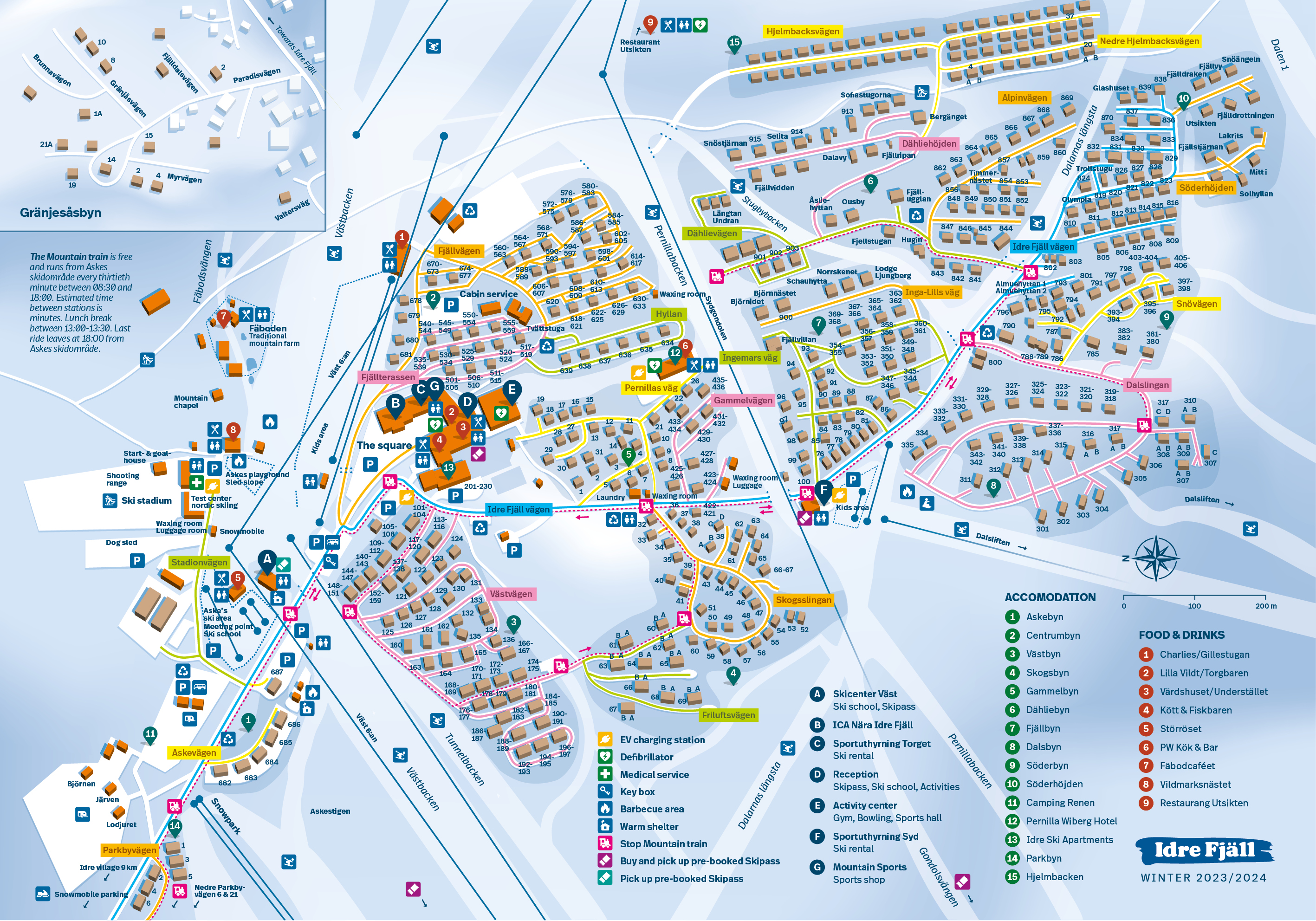
Leave your car and hop on the Fjälltåget (the mountain train)! You can ride for free (you don't even need a Ski pass) between our cottage areas, Askes Ski Area (Askes Summer Meadow during the summer), and the Sydgondolen base station. Fjälltåget is a convenient way to get around the mountain without the hassle of loading and unloading your car. Dogs and bikes are welcome, subject to space availability.
08.30 - 18.00
Askes Ski Area – The Square – Västbyn – Västbyn/Skogsbyn Passage – Skogsbyn – Gammelbyn – Sports Rental South – Dalsbyn Recycling Station – Dalsbyn – Söderbyn – Söderbyn/Dähliebyn Passage – Dähliebyn – Fjällbyn – Gammelbyn – The Square – Askes Ski Area – Sydgondolens Base Station – Askes Ski Area.
Are you looking for information on how to get to Idre Fjäll?